


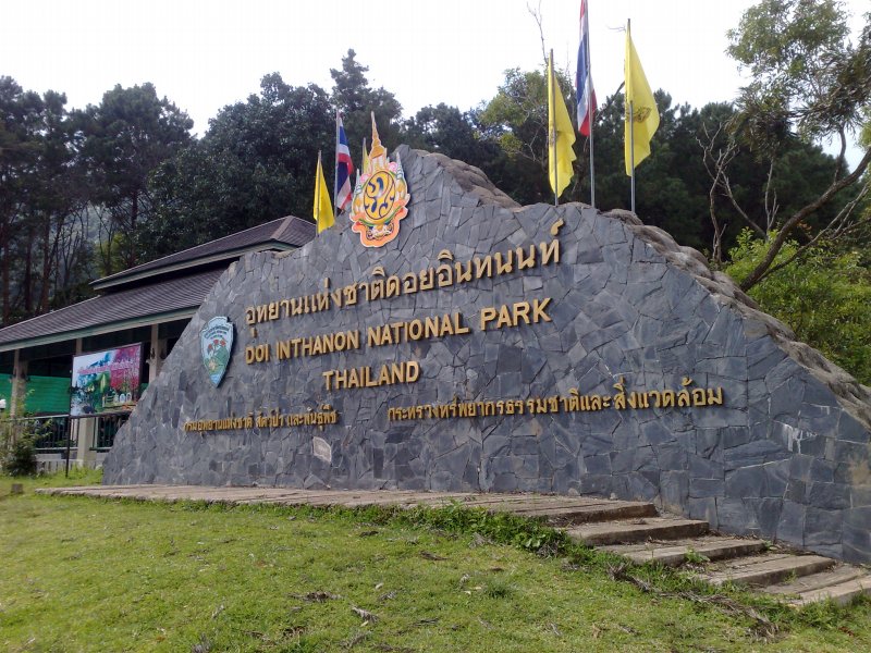
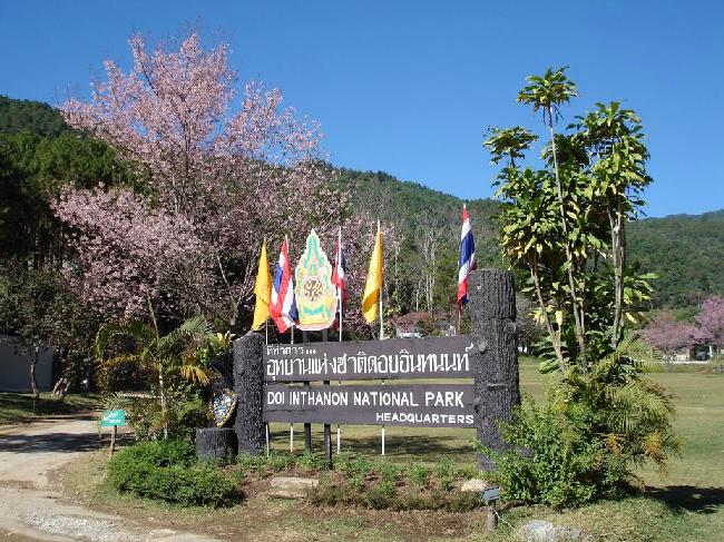
Doi Inthanon
Located in Chiang Mai Province, Doi Inthanon National Park encompasses the highest mountain In Thailand, Doi Inthanon, as well as several lesser summits. The doi (mountain) is largely a granite batholith intruding a southerly extension of the Shan Hills range and forming the divide between the Nam Mae Ping river to the east and the Nam Mae Chaem river to the west. Lower elevations in the most easterly pant of the park are limestone formations and contain a number of caves.
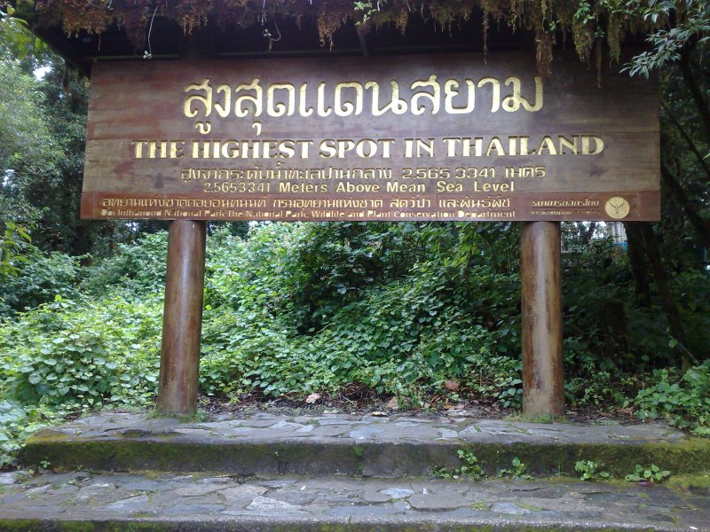
Formerly known as Doi Angka, the mountain now bears (since 1899) a shortened version of the name of Chiang Mai's last sovereign, King Inthawichayanon. During his reign, he had, with great foresight, expressed his concern for the forests of the northern hill country as the watershed for all of central Thailand. The modern study of rain forest hydrology has borne out his early convictions and given substance to Thai folklore which describes this hill region as the home of the Phiphannam, the 'spirit who shares water'. Before the King died near the turn of this century, he commanded that his remains be placed at the top of this mountain: his ashes at the summit stupa are visited by thousands of people each year.
The park covers an area of 48,240 ha. Its lowlands below 800 meters in elevation are warm and very dry during the rain-free season, but the summit of Doi Inthanon, at 2565 meters, has a climate more like Canada than Thailand. The temperature has been known to drop as low as -8 degrees C. and frosts are not unusual during the cool, dry season. January is the coldest month: an average nighttime temperature is 5.5 degrees C. At any season, Doi Inthanon is a comfortable reprieve from the heat of the lowlands. At altitudes above 1000 meters, rainfall exceeds 2500 mm, considerably more than at nearby Chiang Mai. Even in the dry season, November to April, there is rare but occasional rain or the summit may be shrouded in cloud for a part of the day; persistent mist is an important factor in the maintenance of moist forest there.

Rhododendron The various sub montane forest formations at higher elevations are a unique asset of the park. They have dominant species belonging to temperate climate families rather than tropical. The summit area supports the only red rhododendron in Thailand (R. delavayi); it blooms from December through February. There are also two white-blossomed species abundant on Doi Inthanon which are restricted to only a few other sites.
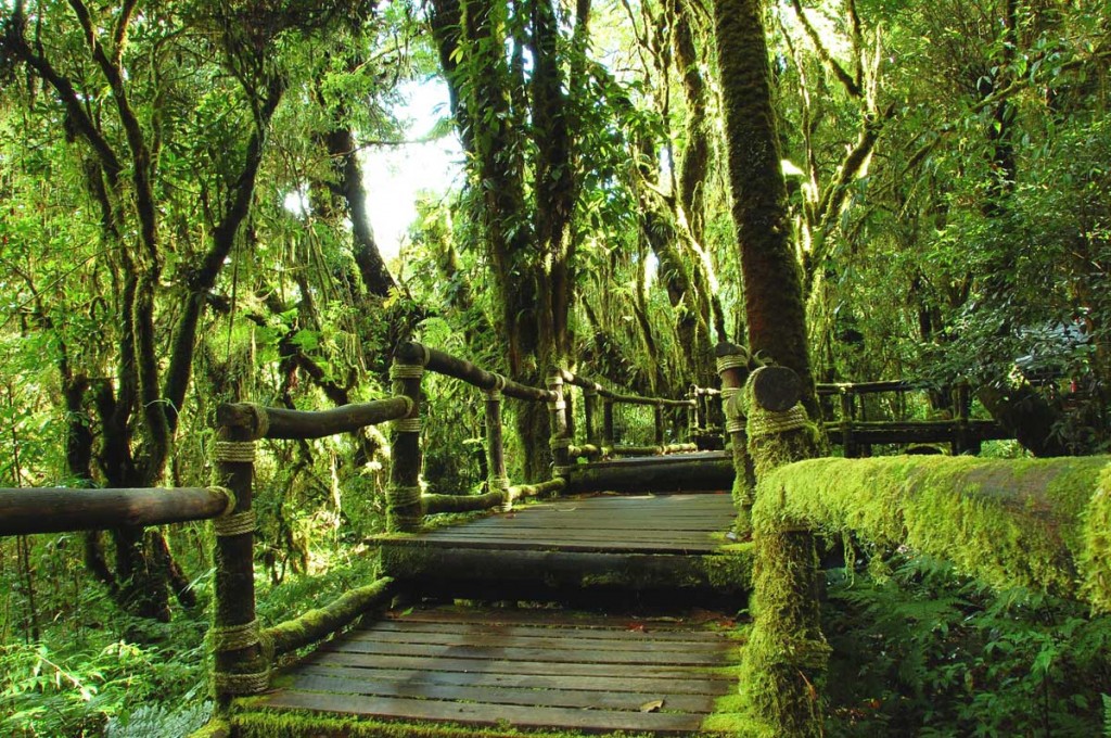
Where mists are persistent, the slopes carry a moist hill evergreen or 'cloud forest' with many epiphytes, plants which live on tree trunks and branches but do not receive their moisture and nutrients from the host tree as do true parasitic plants. Instead, they are nurtured by the accumulation of dust particles and humus around their 'root' area and the moisture retained there, augmented by frequent bathing in cloud and mist. Epiphytic orchids are also abundant, along with lichens, lianas and fern.
road At mid-elevations, 800 - 1500 meters, two species of pine are present, Pinus merkusii mixed with dipterocarp in the lower range, and P. kesiya with oak and laurel on drier slopes in the upper range. The pines are thought to be a relic from a prehistoric cooler climatic period when flora from the Sino-Himalayan region migrated southward. At the mid-elevations of the park, much of the forest has been removed by the activities of swidden cultivators and the slopes have converted to fire climax grasslands.
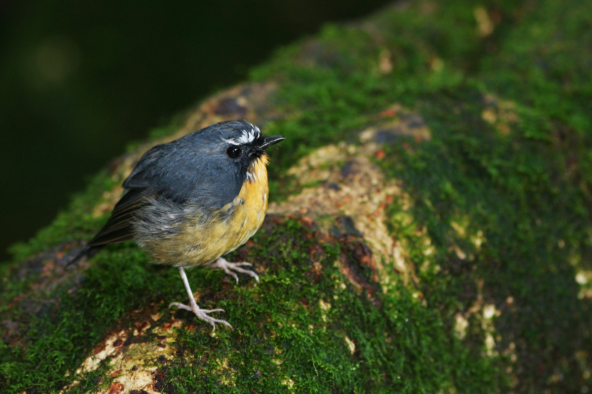
Because of its broad altitudinal range and the cool climate of its upper reaches, the park supports the largest number of bird species of any site in Thailand. The Center for Wildlife Research at Mahidol University records a present total of 362 species and expects additions; Many at the summit are migrants from northern Asia. Species restricted to Doi Inthanon are Ashy-throated Warbler and an endemic race of the Green tailed Sunbird; the park is the only site where the Chestnut-bellied Rockthrush and the Yellow-bellied Flowerpecker are known to oversummer and probably breed. Over 190 bird species are listed as common to abundant. Bird lists are available at the Visitor Center and at Park Headquarters
Private transportation is the recommended way to visit Doi Inthanon. The main attractions are spread over a distance of 40 kilometers and only a private vehicle will allow flexibility in planning your itinerary. Motor cycling is the best mode since it allows travel on some of the rough and narrow dirt roads which lead to hill tribe villages.
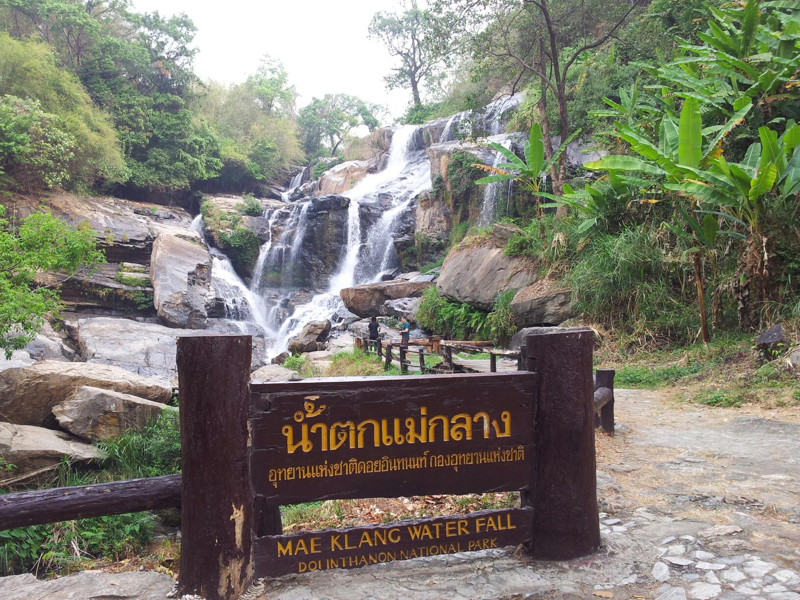
Mae Klang Water fall is located 66 km southwest of Chiang Mai. From Chiang Mai, take Highway 108 to Km 57 (just 1 km before the village of Chom Thong). Turn right onto Highway 1009 and continue 8 km to where the road forks. Mae Klang is 300 meters straight ahead. The summit road forks to the right, reaching Park Headquarters near Km 31 and the summit of Doi Inthanon at Km 48.
The 14 kilometer route to Mae Ya Water fall begins in Chom Thong village. A minibus can be hired in Chom Thong for about 500 baht for the return trip. Mini-buses labeled in English Doi Inthanon Park can be hired at either Chom Thong or Mae Klang for the trip to the summit; the cost is about 500 baht for the return trip. These mini-buses have a regular touring route which includes the main points of interest along the summit road. Per-person costs will be lower it you can share the tour with others. Unmarked mini-buses also leave Chom Thong frequently for Mae Chaem (decreasing in mid-afternoon). The fare is 20 baht to the point where the Mae Chaem road intersects with the summit road at Km 38, or 30baht to Mae Chaem. If you request it, this mini-bus route will drop you at Park Headquarters, Km 31. If you arrive at Km 31 or 38 in the morning hours, you may be able to flag down another vehicle to reach the summit.
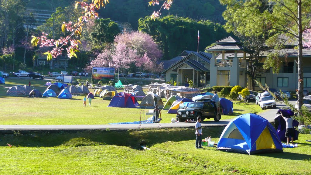
Accommodations: Adjacent to the Hmong village, Ban Khun Klang, behind Park Headquarters, is a large compound with 11 guest houses available for public rental. Electricity, beds and bedding are provided in all units. Arrangements for guest house rental should be made at Park Headquarters.
Campsites are Iocated at the Headquarters area and at the Mae Pan Ranger Station. Two-person tents can be rented at Headquarters. No sleeping bags or mats are available, but a number of blankets are available for rental. Firewood is provided and campfires are permitted throughout the year. Please use caution during the dry season.
Food stalls serving meals and snacks are located at several places in the park (see maps). Stalls at Mae Klang Water fall and in the Headquarters area are open during daylight hours every day. Bottled water is widely available in the park, along with other drinks.
A new information and interpretive center is located at Km 9.5 on the summit road. There is an excellent slide show of the park, plus assistance, maps and other interpretive displays. The Visitor Center can also be reached by a short walk from the Mae Klang Ranger station. The trail follows the river up stream, passes the waterfall and reaches the Visitor Center in a few hundred meters.
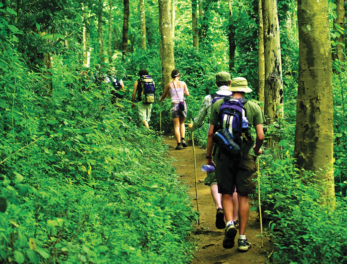
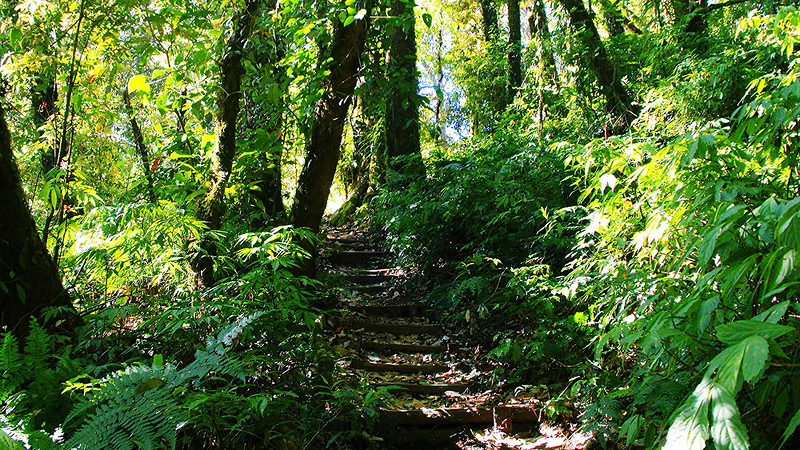
As a result of long occupation by hill tribe people, Doi Inthanon has many footpaths. Some of the main tracks have evolved into single-lane, motorcycle and truck roads providing access to villages. Most walking trails in the park are not signed at the trail head nor marked along the route. If you want to do some walking, please contact the Park Headquarters.
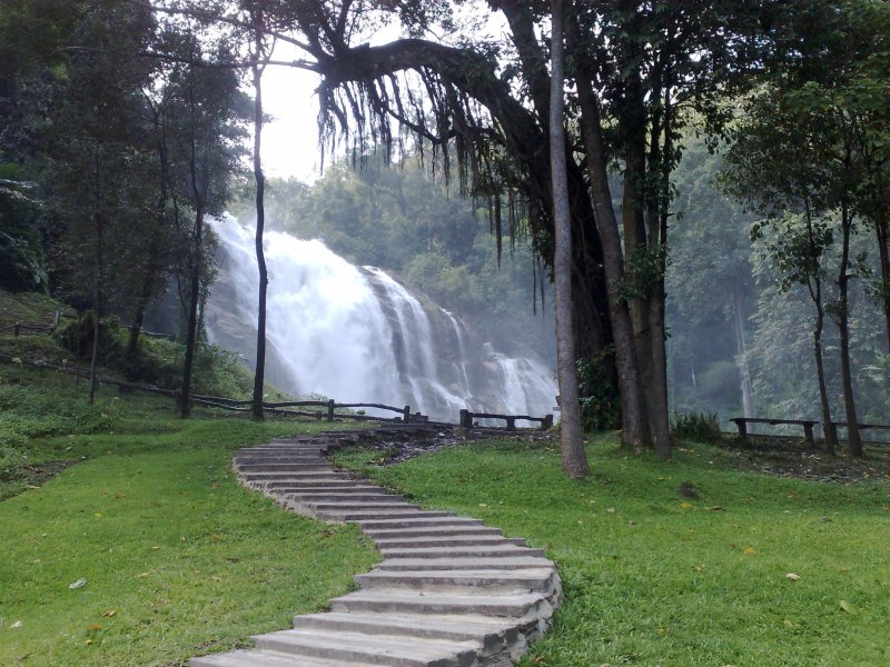
Because of its easy access, this unusual waterfall has been visited by Thai people for many years and they continue to come in large numbers on any sunny day in the year to swim, picnic and relax in this beautiful setting. The rapids and waterfall spill over a wide exposure of granite and can be approached closely. Visitors are asked to exercise caution around the waterfall area and while swimming either above or below the falls. A well-maintained trail leads up the side of the waterfall, and continues to the Visitor Center and beyond.
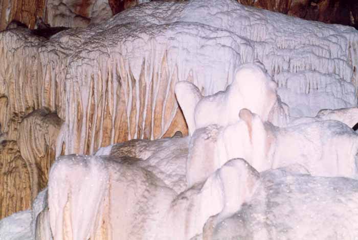
This impressive limestone cave has a gigantic entrance chamber and tower and a second huge chamber with a skylight opening to the surface. It can be reached in about one hour from the main road, or in less time if the beginning portion of the route is cycled.
The falls are reached by a short, easy trail from the parking area. Vachiratharn waters tumble down granite escarpment, creating a misty veil of great beauty. Visitors should be very cautious: three people have fallen to their deaths while taking photographs. Just a short distance on the main road beyond Vachiratharn is the small Karen hill tribe village, Ban Sop Had. Turn right just past the bridge and you will find the village a few hundred meters up the dirt access road.
The headquarters building has a small camping space nearby, and staff will provide assistance. Access to the Hmong village Ban Khun Klang, the guest house compound, and Siriphum Waterfalls via road intersecting with the main summit road at Km 30.4. A excellent view of Siriphum can be enjoyed by walking or cycling along the track which forks left from the main road just beyond the entrance to the guest house compound. The falls are actually twins: two parallel plumes named for King Bhumipol. and Queen Sirikit.
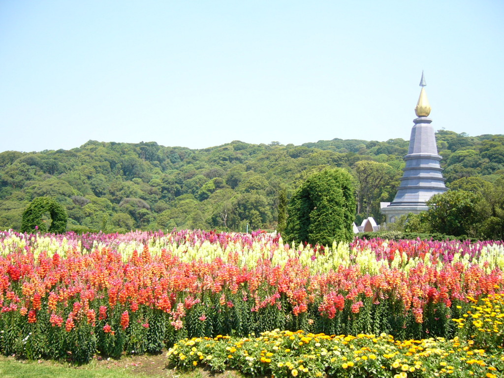
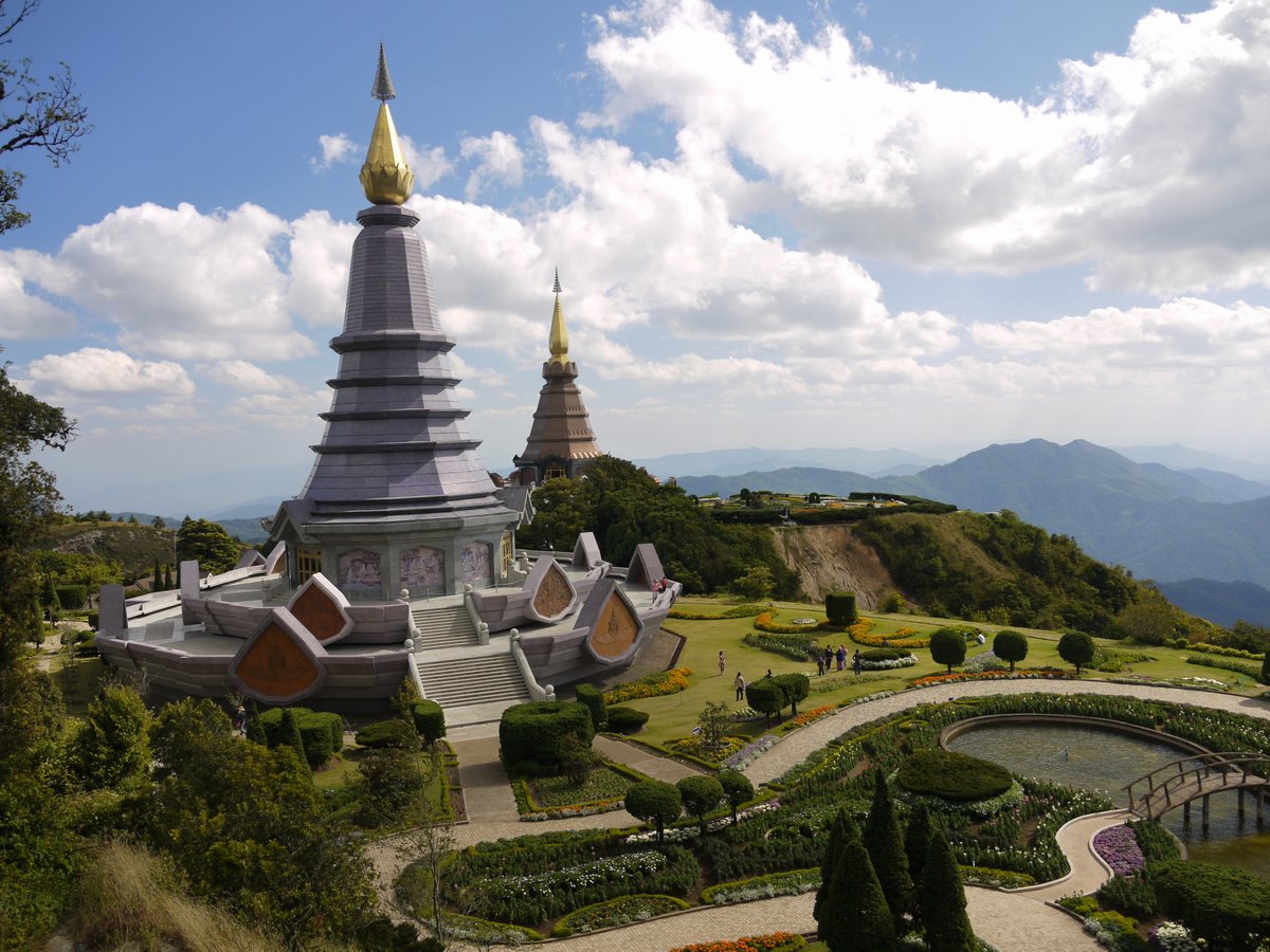
Continuing north of the main summit road, turn left at km 41.8 over a bridge on a paved road which leads to a magnificent chedi completed in 1989 to honor the 60th birthday of King Bhumipol.
One of the most beautiful and rewarding walks in the park is a new trail which begins a short distance up the main summit road from Napamaytanidol. The path leads for a kilometer or more through dense, moist evergreen forest, then emerges and follows the top of a steep slope bordering the canyon headwaters of the Mae Pan River. Dotted with red rhododendron, the trail proceeds southward for another kilometer with fine, open views to the west, then re-enters the forest and eventually terminates at Napamaytanidol Chedi. Two hours would allow a leisurely walk with camera stops.
The drive to the summit offers some fine views, especially during November and December, before the dry season haze has become well established. On your visit to the summit stupa containing the remains of King Inthawidhayanon, be sure to read the English translation on the back of the marble plaque nearby. Photographing any part of the radar station is forbidden, but visitors may take pictures freely of any other subject.
On the main road and opposite the summit Ranger Station is a sign in Thai marking a short, self-guided nature trail which descends to a sphagnum bog in a small karst depression The bog area. which displays the red blossomed Rhododendron delavayi, comes nearest to a true montane forest formation and is a good location for bird-watching. If you continue around the bog and down a short distance, you will reach a memorial shrine marking the site of a helicopter crash which occurred in the mid-seventies and killed the first superintendent of this park.
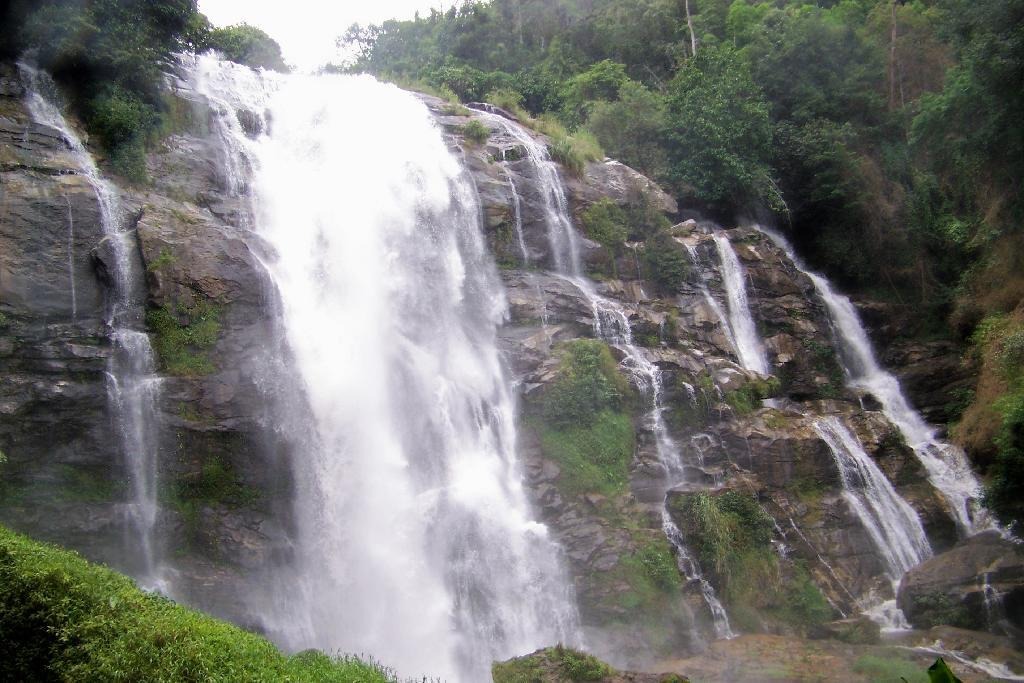
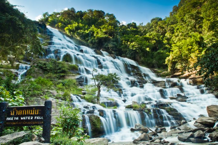
Thought to be the highest in Thailand and is well worth the extra effort to get there. Park officials estimate that the Mae Ya River plunges more than 250 meters at this point. It is a beautiful, fanning cascade, dropping down an ever-widening series of steps -- without a doubt, a photographic favourite.
A scenic pleasure. From the start at Km 38 on the main summit road, the first kilometers travel through some of the most lush forest on the mountain. Then the road comes out into the open and follows a descending ridge with fine views.
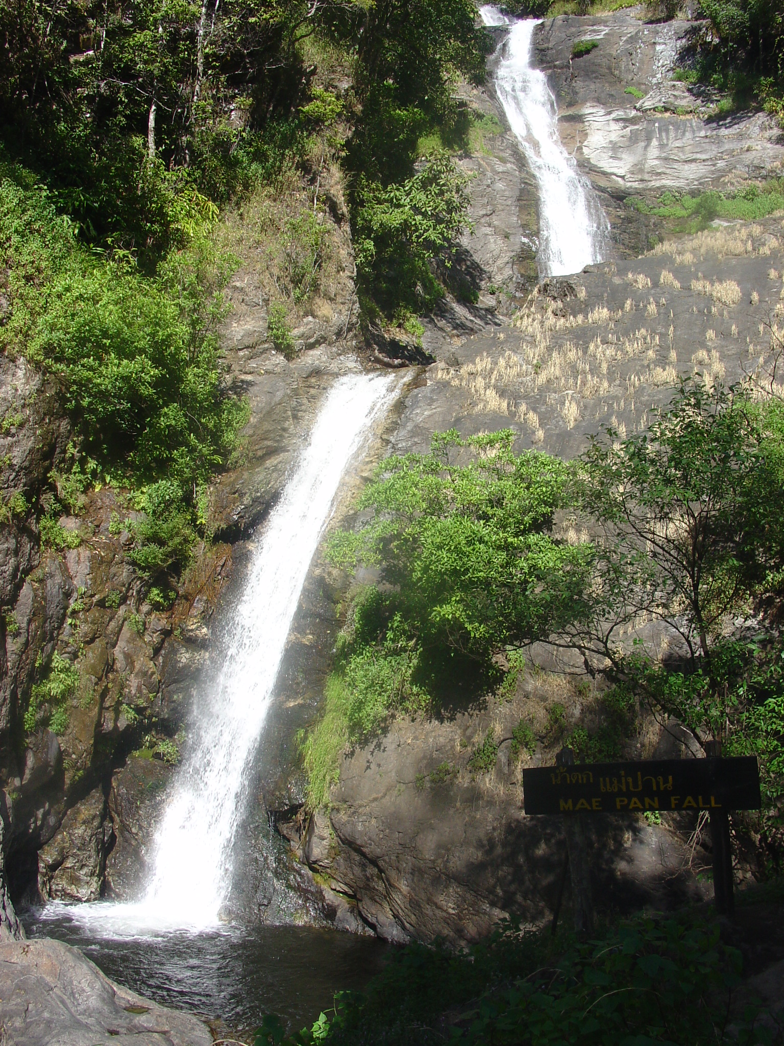
At Km 6.6 on the Mae Chaem road is the turn-off to Mae Pan Waterfall, marked by a sign in Thai and English. The dirt access road descends about two kilometers to the Ranger Station and campground and is suitable for any vehicle although the road can be slippery on the uphill return after a heavy rain. The area is quiet, off the beaten track, and can be described as the back country of Doi Inthanon Park. It offers a rewarding loop hike of 1.5 to 2 hours through untouched terrain with small waterfalls and tumbling creeks along most of the route. Visitors can walk the 800 meters to Mae Pan Falls and back again, as well as the 200 meters to Huai Sai Luaeng Falls just beyond the campground. Both of these trails are clear and well-maintained.